The Problem
In El Salvador, information about public transportation routes and the country's new geopolitical distribution wasn't centralized or easily accessible. Users needed a modern and visual tool to navigate Salvadoran territory and plan their routes.
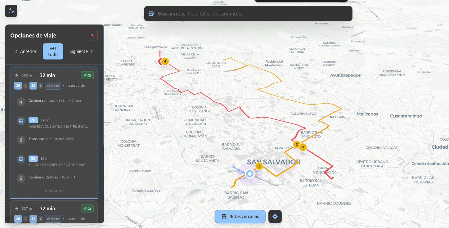
The Solution
ChivoMap is a geolocation web application that combines interactive maps with public transportation information. The architecture uses:
- React Frontend - Dynamic and responsive interface with Leaflet for map rendering
- Go Backend - High-performance REST API to serve geographic data
- Node.js - Data processing and auxiliary services
- Leaflet - Open source interactive maps library
Technical Challenges
Performance with large data volumes
Optimizing the loading and rendering of multiple map layers with thousands of points of interest and bus routes without affecting user experience.
Geographic data integration
Processing and normalizing data from multiple sources to create a consistent and updated geographic database.
Impact
Proyecto de código abierto disponible para la comunidad
Arquitectura preparada para crecer con nuevas funcionalidades
Stack tecnológico actual y mejores prácticas de desarrollo
Interested in collaborating?
If you have a similar project or want to discuss web development and software architecture, contact me.
Send message